This page has four maps. This first one is of Trails End, near where Herd Bellasara rules
This one highlights the sections of Trails End.
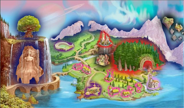
In dark blue we have the North of North landmarks, The World Tree, Sara's Cliff, and The Bella and Bello Mountains.
In purple we have The Arena and The Bazaar Tent.
In pink we have Farms and Cottages.
In lavender we have the Grain Mill.
In red we have Rolandsgaard Castle and Horseshoe Forest.
And in black we have the The Floating Islands and The Town Square.
This is a map of the entire land of North of North.


And finally, the territories of the map.

As you can see, Herd Airistos isn't there. This is because they live on floating islands that rest above the mountain range between Herd Bellasara and the Midwinter Mountains.
Hi! I really love the new map! How about you? I am currently working on an even more complex map labeling the parts of BellaSara. It's far more detailed than I expected! For example: In the Autumn Sands, the one main oasis that everyone lives in or near bacause its impossible to live anywhere else, is called Aria. The three mountain ranges surrounding it are the Ochre Mountains, Midwinter Mountains, and Bow Mountains. The river that runs through it is the Hope River, and the rock formations to the left of it are the Pinto Mesas. The bay above the Autumn Sands is Crystal Bay.
Kitty305 :3